Kartbanken
Kartbanken is our online shop for map and engineering design data. You draw the area you need in the map, choose a product and file format, and get the data delivered by email. The price is calculated from the product and the area before you order.
Kartbanken is currently a separate solution with its own log-in at kartbanken.propcloud.no.

Who Kartbanken is for
Architects, design engineers and consulting engineers who need base data for a specific project area: terrain with contour lines, buildings, roads and property boundaries in a format that opens straight in your CAD or GIS tool. One order covers one area, and you pay per order. The user account is free.
Products
All products come from Kartverket. You choose the file format per product, and you can include several products in the same order.
| Product | Content | File format |
|---|---|---|
| FKB with 1 m contour lines | FKB, the most detailed map data, with contour lines for every metre | Shape, DWG |
| N5K | Map data adapted to the 1:5,000 scale | Shape, DWG |
| N20K | Map data adapted to the 1:20,000 scale | Shape, DWG |
| Orthophoto 10 cm, 15 cm and 20 cm | Aerial photos with the stated ground resolution | JPEG |
| Laser | Point cloud from laser scanning | LAS, LAZ |
| EiendomEier | Property data from the matrikkel | Shape, DWG |
| Administrative boundaries | Kommune and county boundaries | Shape, DWG |
| Postal zones | Postal code areas | Shape, DWG |
| Digital terrain model 10m | Terrain model with 10 m resolution | DEM |
Shape opens in GIS tools such as QGIS and ArcGIS, DWG in CAD programs such as AutoCAD and Revit. LAS and LAZ are point cloud formats. LAZ is the compressed variant and gives smaller files. If you are unsure which format your project needs, you can tick both.
How to order
-
Log in at kartbanken.propcloud.no. If you do not have a user account, you register there.
-
Find the area. Search for an address or street in the field at the top right, or zoom in the map.
-
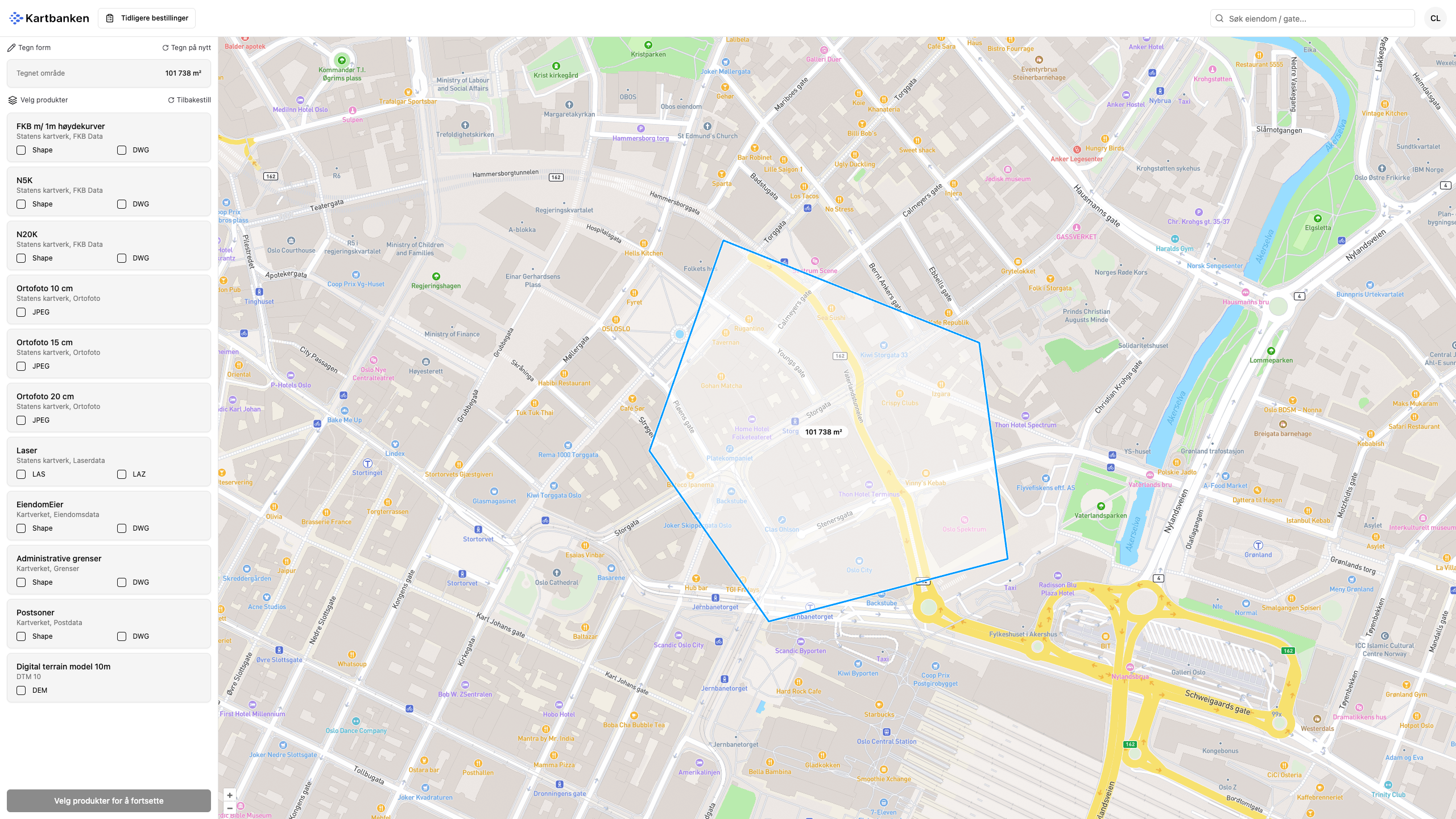
Click Draw polygon on the map and click the points around the area. Click the start point to close the shape. The pointer snaps to it. The area is shown under Drawn area. Draw again starts over.
-
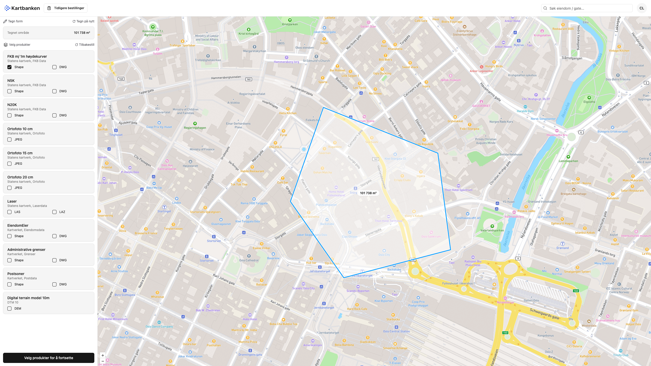
Select a product and file format in the list on the left. Tick more than one if you need to.
-
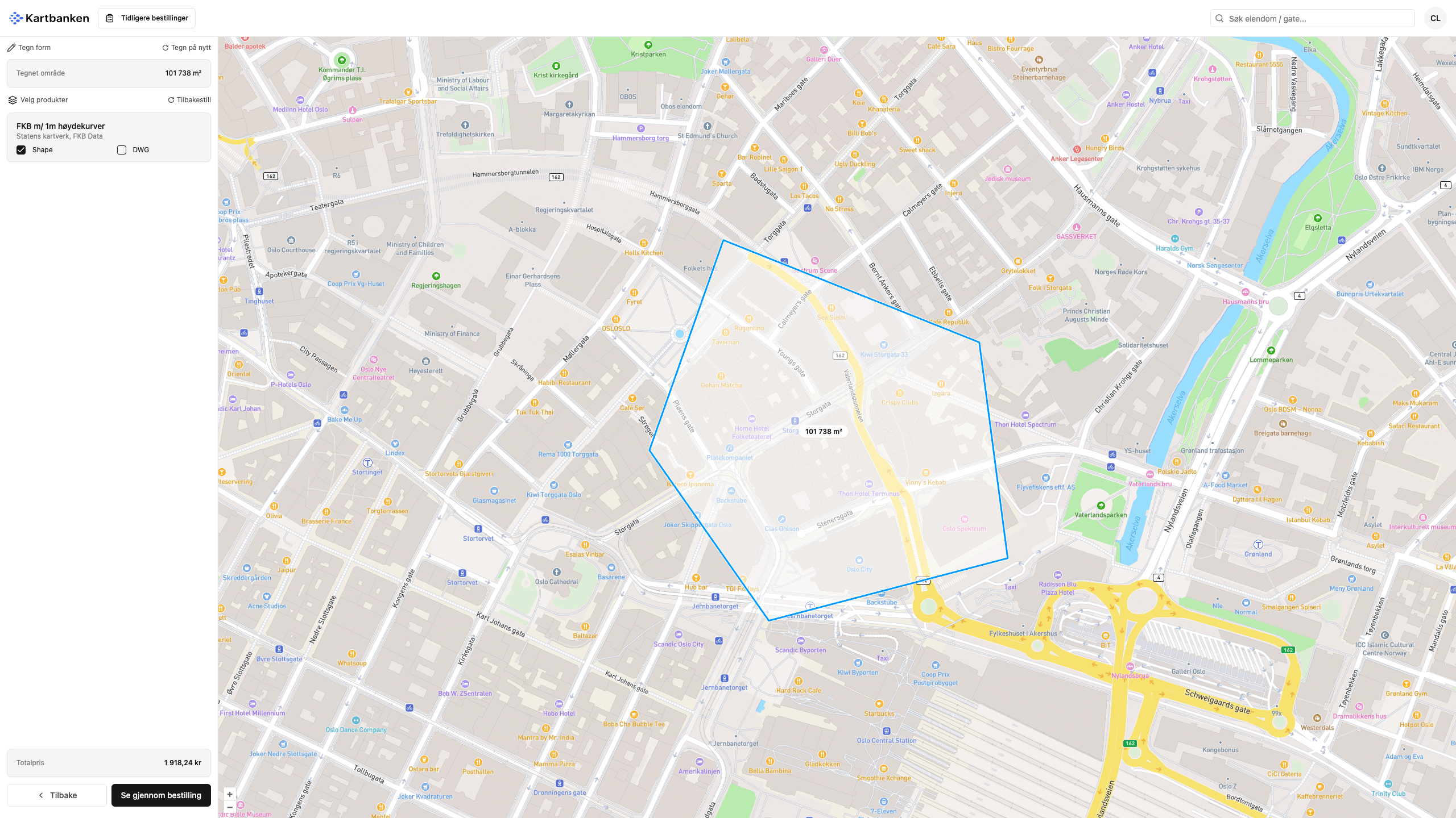
Click Select products to continue. You see the products you have selected and the total price.
-
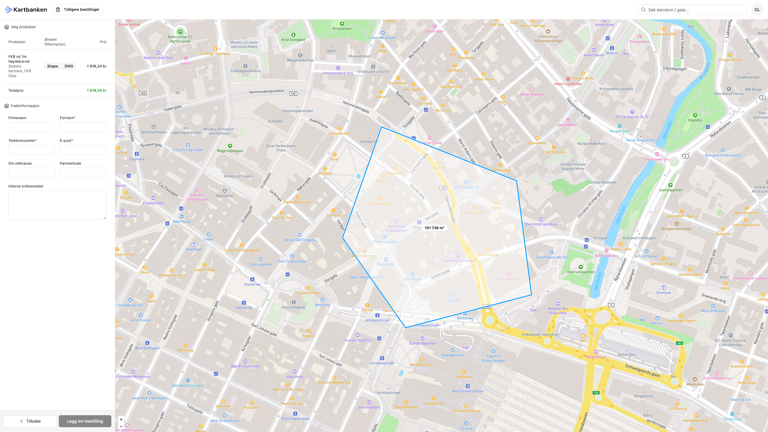
Click Review order. The price per product and the total price are shown at the top, and you fill in the delivery details below. First name, phone number and email are required. You use Company name and Your reference when the order is to be invoiced to a company other than your own, for example a project company or a client.
-
Click Place order. The receipt arrives by email, and so does the download link once the data is ready.


Previous orders at the top left shows everything you have ordered before.
Kartbanken in Placepoint Fusion
Coming soon!
In Placepoint Fusion you order map data for an area straight from the map you are already working in. Today you order at kartbanken.propcloud.no.
See also
- Map layers: the map data you can see in Placepoint Fusion without ordering.
- Data and sources: where the data comes from and how often it is updated.
- Kartverket: the supplier behind all products in Kartbanken.